The New Lyke Wake Club
Unsupported Crossing : 22nd July 2018
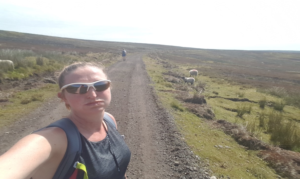
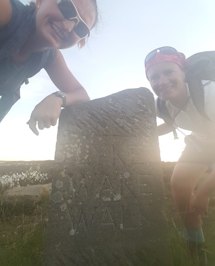
My sister and I took on the LWW at the weekend meeting up for a girlie weekend away. Here’s our report!
Our Lyke Wake Walk in stats (aka. The Walk Mostly Fuelled by Hula Hoops and Sheer Bloody Mindedness).
Crossing date: 22nd July 2018
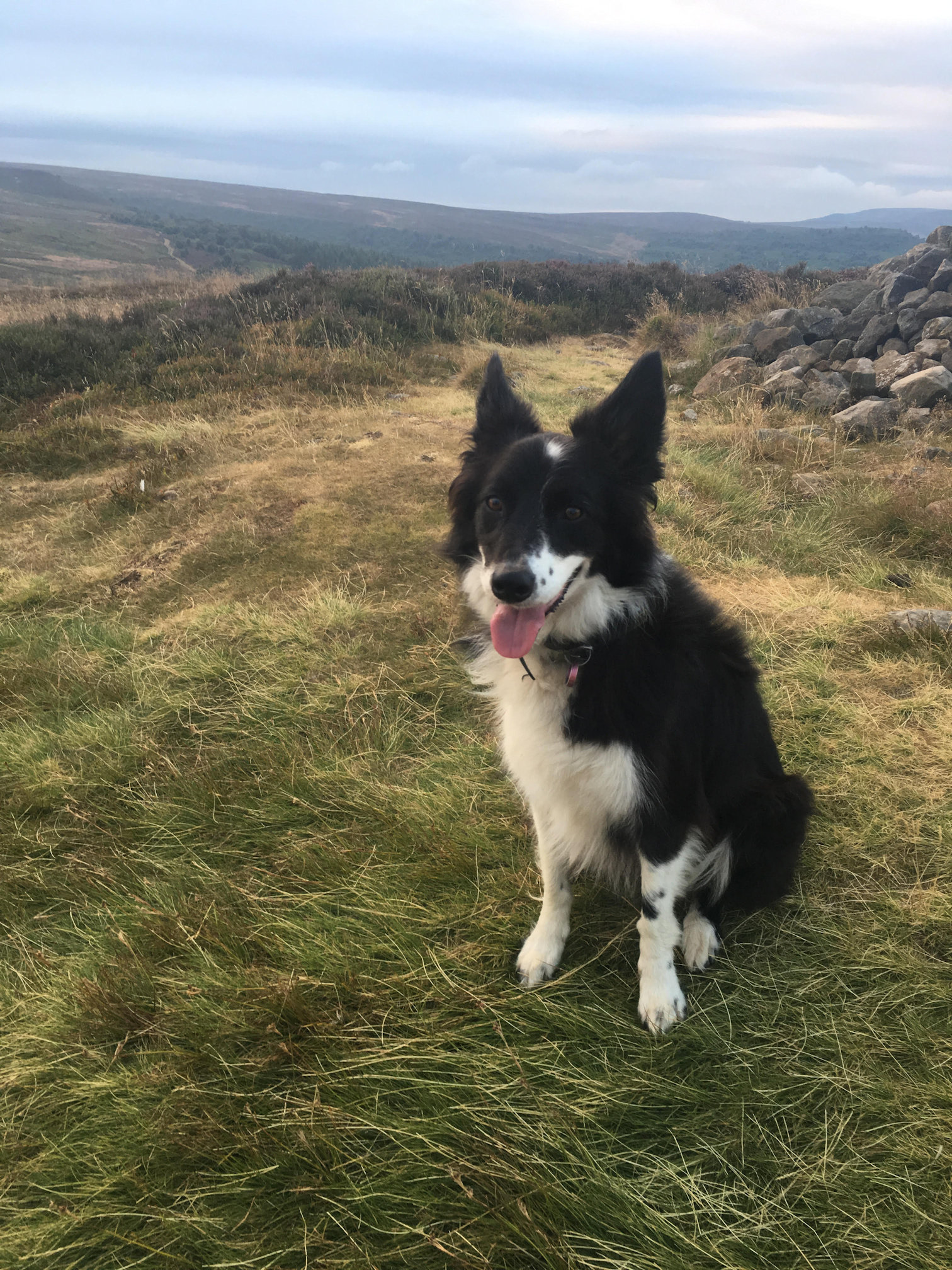
Number attempting and completing: 2 humans (sisters) and 1 dog (Milly)… unsupported.
Forecast temperature: high of 21 degrees C (never, ever trust the forecast).
Actual lowest temperature: 22 degrees C (early morning and evening).
Actual highest temperature: 27 degrees C (most of the day, in fact it felt like the whole day).
Breeze: non-existent (although there were fleeting moments of hope).
Number of times we were relieved we’d packed our waterproofs: minus 10
Litres of factor 50 required: Oh a lot (we’ll both burn to a crisp at the slightest sign of sun).
Litres of water: started with 6, re-filled at The Lion Inn where we stopped for a bite to eat and some fizzy pop! Milly drank from streams where they weren’t dried out. For the last 10 miles we were rationing to make sure she had plenty (everything was dried out).
Number of bags of Hula Hoops consumed: 6.
Number of jelly beans consumed: at least 1000.
Number of Druid’s seen rambling about: 1 !!!???!!!
Number of other people seen walking on the route: 7 in total!!??!
Number of times calling a taxi was discussed: lost count.
Number of blisters: 3 little ones at the mid-way point, 4 at the end (basically 4 big foot shaped blisters and yep our boots were well worn in and do fit properly).
Number of times we were relieved we had an OS map, compass, GPS and that one of us was a member of Search and Rescue: many, very, very many.
Time walking: 14 hrs 25 mins
Number of miles walked: 42 (plus a bit to get back to base) for humans, probably twice that for Milly!
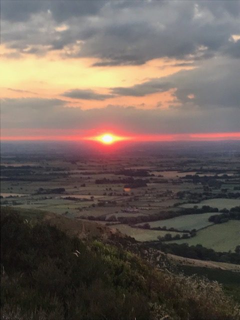
Number of sunsets watched post walk with prosecco: 1.
Preparation the night before: 1 DIY spa facial and Pimms, 3 course meal and 10pm to sleep. The facial really, really helped!?!
Number of calories burned during the walk: 6000.
Number of calories consumed after the walk: quite a lot more than 6000.
Number of sore, slightly broken (but chuffed) people at the end: 2
Number of sore, slightly broken dogs at the end: 0
If we were doing it again we’d be tempted to stash some supplies at a couple of the later checkpoints!
Best wishes,
Joanne(Northumberland), Angela (Cornwall)

……………………………………………………………….They defied the Eagle Owl !
3/4 on 2nd July and a Crossing on 16th July 2018 !
I first heard about the Lyke Wake Walk about eight weeks ago when we had some guests staying in our holiday let and they had walked it at some time. My sisters and I had already arranged to walk the Yorkshire three peaks on Tuesday 19th June but there was something about the LWW that kept calling to me. I spoke to one of my sisters about it and she said she was up for it, and we arranged to drive up to Yorkshire on Sunday 1st July and start the walk at 2.15am on 2nd July. We got together as much information as possible including the book written by Brian Smailes. We began our journey at the allotted time each carrying 4ltres of fluid, rain gear,2 spare pairs of socks, talc, plasters, food, scarf, gloves and a foil blanket . We went prepared for all kinds of weather. Our journey began quite well until we reached Scarth Wood Moor where we became quite confused. After about half an hour going this way and that way we decided to turn right and descend down the track to the cattle grid. YIPPEEEE. From there on it went reasonably smoothly even though we spent time making sure we were heading in the right direction. It all went badly wrong when we got to check point 5. We walked across the bridge as directed and up Ella Beck to the top of the field where we were directed to turn right but then found another passage which told us about a permissive route. We finally got onto this route. We were so pleased. We walked along the track to and from the RAF site until we saw a track saying Robin Hood Bay. As we weren’t sure we walked past this footpath. We met a man on his bicycle and decided to ask the way. He said we should have taken the track which said Robins Hood Bay but be careful not to take the right hand fork. We continued down this track for about an hour. It was very uneven. We decided that we had gone wrong. We could see the clouds getting lower and fog coming in. It was now about 8.30 in the evening. We started cutting across country to our left. We were getting concerned and delighted when we heard a car in the far distance, but even more delighted when we saw the headlights, this made us motor on. We finally reached the road at 9.30pm and we flagged a car down. We were so lucky a very kind young couple. He got out and helped us off with our ruck sacks and put them in the boot of his car. We got in and they drove us to Ravens Hall hotel where we were staying. We enjoyed a bath, a pint of beer and a couple of bags of crisps. We went out like a light. We enjoyed breakfast and then went off to find the end of the LWW. It was such a shame that the last bit of the walk went wrong as we had done so well.
Because of the situation I needed to satisfy myself by doing this challenge again. So, on Sunday 15th July 2018 my husband drove me up to Osmotherley. We left Rye in East Sussex at 9pm and arrived in Osmotherley at 2.45 am. I set off on my own at 3am with 4 litres of fluid, food for the whole journey, wet weather gear, 2 pairs of spare socks and talc, scarf gloves. I set off at 3am with a head lamp on, as I reached the first summit I saw there were other hikers with headlamps on. I was quite pleased that I would not be on my own. As I carried on the other hikers went off in another direction and disappeared. I thought nothing more of it until the headlamps popped up again and I realised they were the eyes of the sheep. I had a little titter to myself and carried on with my journey. I arrived at check point 1 at 05.10 feeling fine. All going to plan. Reached check point 2 at 06.40. On with my journey. Reached check point 3 after the long gruelling train track at 9.50. Check point 4 I arrived at 12.10. Sat and guzzled water and had another jam sandwich and started walking banana in hand.
I enjoyed this part of the journey, I had done over half way and felt pretty good. By the time I reached check point 5 I was feeling a bit fatigued. I changed my socks here and gave them a sprinkle of powder. Off I set on my journey. I reached the top of Eller Beck and turned left onto the gravel track to the end where there is a gate. walking straight across the track to a continuing path to Lilla Howe. From then on it was all plain sailing or walking. I reached check point 6 at 5.30pm and continued on to check point 7 arriving at 6pm. My husband was at each check point( except 4 as he couldn’t find it ) just to make sure I was ok. On reaching the hotel discovered that our room did not have a bath. I almost cried, my poor feet needed a good soak. They very kindly found another room for us with a bath. After a long lingering bath a pint of beer and 2 bags of crisps I fell straight off to sleep. I would recommend this walk and would enjoy the challenge again in the future.
After reading the LWW book I feel I deserve to be a witch and have a LWW badge. I also feel that my sister who walked with me the first time also deserves some acknowledgement. Please could you put this to the LWW club and see what they say as we walked extra miles by going wrong.
My name is Jackie Parsons I am 62 years old and have thoroughly enjoyed walking the Lyke Wake Walk.
Crossing Report – July 20/21 2018 Crossing in Memory of Arthur Puckrin (1938-2018)
Following Arthur Puckrin’s funeral on Friday 20th July, I crossed W-E as a tribute to him as a good mate, a great Yorkshireman and one of the finest of Dirgers of all time; a truly inspirational character. In the early days of the Lyke Wake Walk there was no guide book and only general rules of what constituted an acceptable crossing plus the fragmentary route descriptions that had appeared in the Dalesman, Yorkshire Post & one or two other local newspapers. Arthur Puckrin first crossed as a teenager in 1956 having been told about Bill Cowley’s challenge & the first crossing by a scouting friend, Bill Dell who had taken part in the 1st crossing the year before. At that time there were no tracks in many places on the moors so Arthur planned his own route with the intention of going directly eastwards from the Trig Point start, over Whorlton Moor (a route that had been considered for the 1st crossing), then beyond Rosedale, Arthur used to go more northerly route across Egton Moor in order to go north of the Fylingdales military firing range (you needed a Ministry of Defence permit to go that way & there were unexploded bombs on the ground).
So I departed Scarth Wood Moor directly to Holy Well Gill shooting hut, round the head of Scugdale via Green Howe & Cock Howe to Chop Gate (the Buck Inn has great ice cream!), onwards to Urra Moor. From Rosedale Head Arthur’s route goes further north than the Classic Route to Glaisdale Head, then Pike Hill, Goathland, Sil Howe, May Beck, Evan Howe, The Flask, Beacon Howes and Ravenscar. 45 miles if anyone else fancies having a go! A flipping long way round if you ask me, definitely a young man’s route!
God bless you Arthur mate, Rest in Peace. I hope you are as fleet of foot on your journey over Whinny Moor as you have been in this life.
Crossing 30th June 2018
I first heard about the Lyke Wake Walk in about 2000 had had considered attempting every year since then, but something had got in the way. This year, I decided, was going to be the year!
When I mentioned the walk in passing to my friend, MK, he immediately said he would like to come along. We then mentioned it to a third fiend, SA, over a few beers he agreed that it sounded ‘fun’ and signed up for it. I should perhaps note here that the three of us have been fiends from school and were all best men for each other – just the kind of people to undertake this kind of challenge with.
The date was set for our west to east walk – 30th June 2018. We had about six months to prepare but sadly other things got in the way. I managed two decent(ish) walks (24 miles and 27 miles), MK managed one (the 24 mile walk with me) and sadly SA didn’t manage any. As a result it was decided last minute that SA would only walk as far as The Lion, and only MK and I would go for the full thing.
Friday afternoon was spent hiding water in a few locations on the route, before myself and MK met up with SB at The Lion so we could leave his car there, and proceed in my car to Osmotherley. We had booked into the Osmotherley YHA for the night and toddled into the village for some dinner. I must say this was perhaps our first challenge. The sun was out, the beer was flowing, and it was very (very(very)) hard to limit ourselves to only a few beers and then turn in for the night so we could be up at 03:45 the following morning. We managed one in each of the three hostelries and then MK took over and said it was time to go back and sleep.
03:45 hrs on the morning of the 30th June 2018 – our D-Day.
MK was up immediately with the alarm and opened the curtains/turned lights on so SA and I ended up awake very quickly. Kit was already prepared and we were out of the hostel a touch after 04:00 hrs, and up to the starting point within about 15 minutes. This was perhaps the nicest part of the day as it was bright and cool. Later the sun would hit.
We had one minor mishap early on when I decided it would be best to go up on to the top of Whorlton Moor rather than through the woods, but they forgave me for that. I’m not sure that extra climb would have been very welcome at the other end of the route. Then followed the ups and downs of the first section to Lordstones which I think took us all slightly by surprise – they really were a little more uppy and downy that expected.
All the time we had been aware of a group about a mile or so behind us and we were keen to keep in front of them. On the section between Lordstones and Urra Moor we spotted them……… skirting around the low ground to the north!!! We did consider this as an option for about a minute, but then thought if a job is worth doing it’s worth doing properly.
We really did enjoy this section of the walk. It was still quite cool, and the views were stunning. We actually stopped to admire the views – something that would happen less and less as the walk continued. It was also nice to wander along chatting and catching up. This chirpy conversation is also something that would be limited at times later as we drifted into our own little (painful) world.
Urra Moor to The Lion was something of a slog. The walking was relatively easy, but the railway line didn’t seem to end. Plus it was now starting to heat up. There was actually a heat haze when you looked ahead along the railway line. Plus there were all the fit bods who were running along past – that can be quite soul destroying!!
I think SA was also thinking about the beer and relaxing afternoon he was going to have as he increased his pace along the railway and I think we (well I) may have pushed it a little hard. But still, we made The Lion for about 1230 and had an enjoyable break. I changed socks and used talc for the first time (a top tip from a friend). I also changed from trail shoes to real walking boots. Oh, and I drank coke. Ordering a soft drink in a pub doesn’t sit well with me, but I actually wanted a soft drink and not real ale. Quite amazing!
We discussed the afternoons we had ahead of us. MK and I would continue on walking in the now blistering heat. SA would, on the other hand, go to Whitby, check into the hostel, have a nice shower, have a plodge in the sea, and then go for fish and chips. We did consider joining SA and sacking off the walk, but figured we had to continue. So one we set off.
I was quite pleased I had changed my boots as I went over on my right ankle almost immediately. I think the high boots probably saved me from resurrecting an old problem, so felt like something was on our side, and we quickly got in to a nice pace. Shunner Howe was crossed in quite good time, and we had a bit of a break at the carpark on the road near Shunner Howe where we had some water stashed. The next section of moor, however, really was a bit of a slog.
The breeze had dropped and the sun seemed hotter than ever as we crossed Wheeldale Moor. Plus the peat was so dry the rocks were out and it was quite unpleasant walking. MK and I had also now almost stopped talking as we both sank into our own little world. This was broken by the view of the drop down to Wheeldale Lodge!!!!! 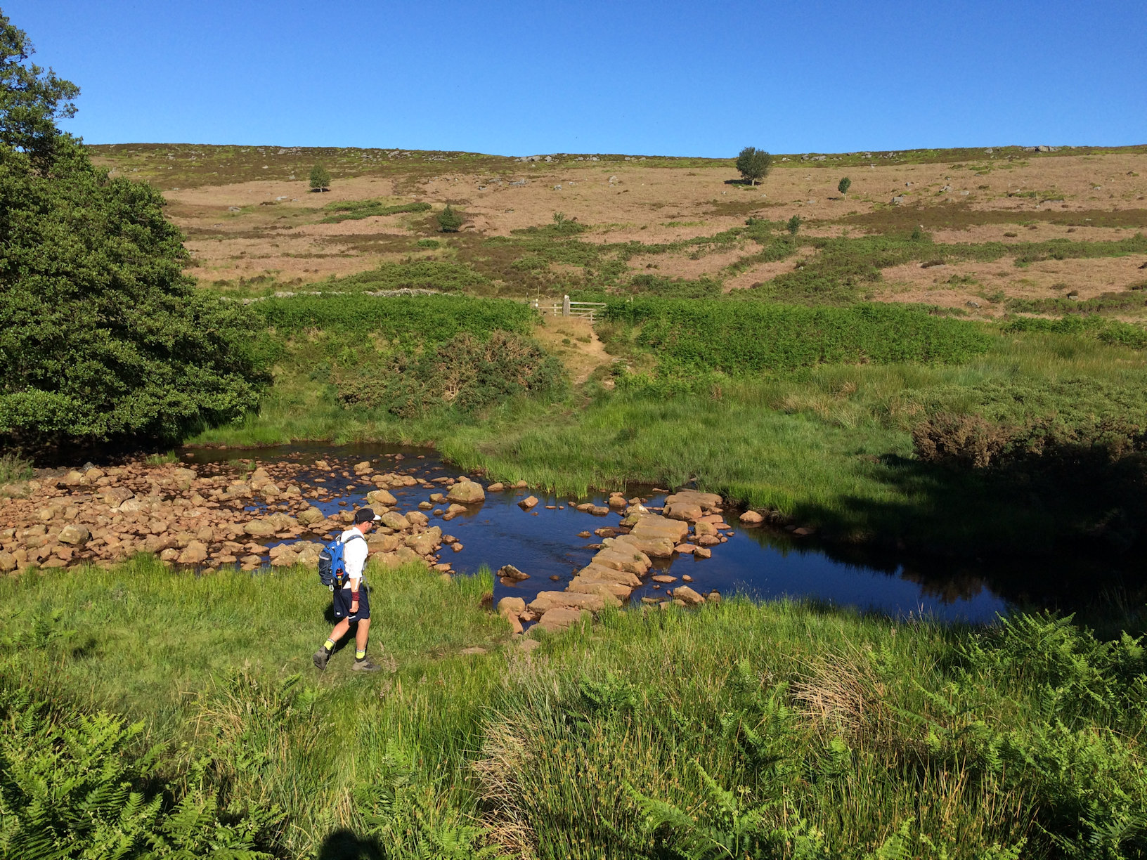 It was that kind of descent that you thought would never end as you kept going over the edge, but couldn’t see the bottom. Plus you knew that every step you took down would be matched by a step up on the other side.
This might have been a low point for me. I think I swore a lot when I saw it, and then a bit more when I looked back at it over my shoulder. Oh, and when I thought I was stepping onto solid ground after going over the stepping stones only to actually put my foot on a pool covered in mud and go in manky water up to my knee!! However this first up and down at the eastern end of the route was good as I felt I still had energy reserves for a bit more walking, although I didn’t quite realise how much more there still was to go!
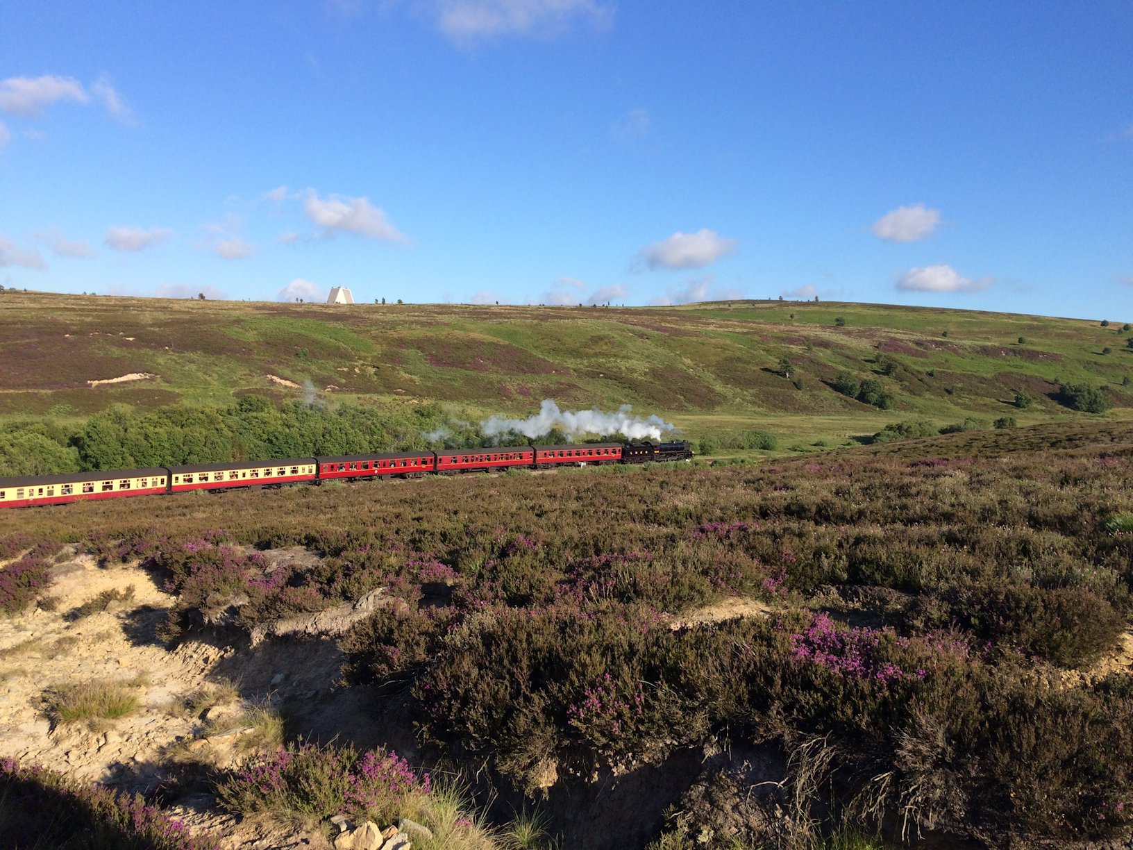
I should perhaps add at this point that we had, for some reason, kind of told ourselves that once we saw RAF Fylingdales we were pretty much there. All we would have to do was climb onto the high ground and we would see the finish line and that would be it. This was something that we felt must be true as a support party we stumbled across just after crossing the railway line reassured us that we “didn’t have far to go”. This was music to our ears. We had seen the steam train when crossing the track (which pleased me enormously), and such reassuring words from the strangers really made us think we were almost there.
Then I looked at the map again……
I think the next section was a bit of a low point for MK, and I don’t think he’ll mind me saying that. For a good while I kept on saying it was only about 5km to the finish line every time he asked, and for a while he believed that. But only for a while…….after that I think he started to realise I was lying. I then saw something I never thought I would see as we approached Ella Howe – MK eating a full malt loaf. Not cut up and buttered. Oh no. A full, unsliced malt loaf.
This was quite a spectacle, but it did the job and he perked up, and we trundled on.
At lunch we were confident that we might finish for 1800 hrs. Perhaps even 1700 hrs. It was now about 1900 hrs and we realised that our early finish and drinks in the pub were a distant dream. However the views from Ella Howe were wonderful, and it was nice to have a little break and think about the fun we could have been having in Whitby. I texted a few photos to a friend who had completed the walk before and he replied with a brisk “Good spot, now stand up and get on with it”.
Jugger Howe Beck was reached as a kind of mist was coming down, and I spent some time wondering how people running the route felt as they approached that valley after covering so many miles. It now seemed to be taking some time to cover the miles and the section from Jugger Howe to the A171 seemed to take an age.
At about this time we received a call from a friend. I should have mentioned that all three of us were supposed to be attending a school friends stag do. The invite have been received a week after picking our date for the walk and as a result we had been forced to make our apologies and had to explain we could not attend because of our ‘adventure’. The idea of a call from the stag party in full flow was not appealing and I’m afraid we had to ignore the call. Hearing the cries and laughter of a bunch of inebriated friends would not have made us feel much better!
We also received a call from SA who was, helpfully, sat in his car on the finish line waiting for us. We reassured him that we were alive and that we were not far away, but that we could not see the mast due to darkness and the mist, but as we had crossed the A171 we must be near.
Onwards we walked and then finally we spotted the mast. One last slog along the track brought us to the mast and the lights of the car. FINALLY!!
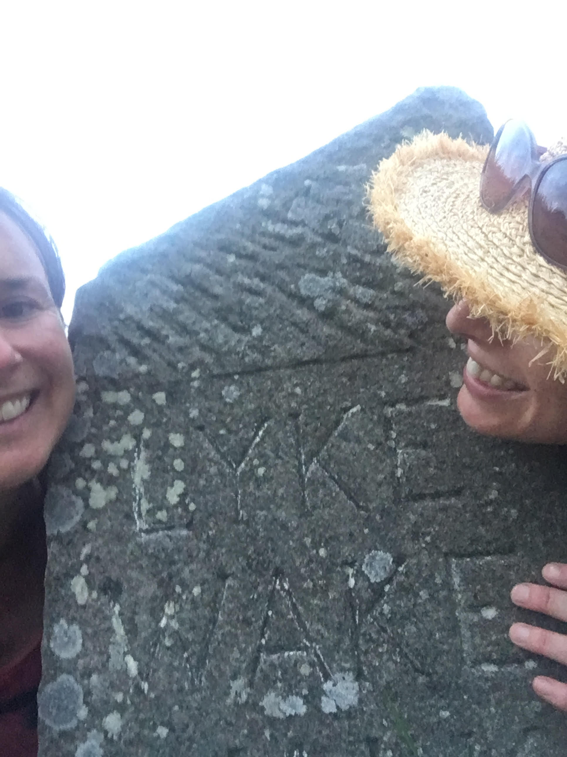
We remembered to have a quick photo by the finish stone – sadly rather blurry with the two of us looking far from our best – and then into the car. It was now about 22:30.
MK fell into a bit of a daze/sleep very quickly and I think I jabbered on to SA during the drive to the hostel.
At the hostel we shuffled to the room and then shuffled to the shower. Amazingly we had no blisters, although there was some chaffing – I’ll leave it at that.
We had a little whiskey from the hip flask and then sleep. Wonderful sleep.
The following morning we were stiff, but surprisingly well. Breakfast was consumed and very much enjoyed, before we made our way back to the start line to pick up my car for the drive back north.
That evening my wife and I attended a concert at the Sage and heard Racheal Unthank singing about Fylingdales Moore and Wheeldale Moor, names that I hear in a very different way now.
By Monday the stiffness was going as I boarded a train heading north at 06:30 hrs for a week of work in the Highlands. The thought of putting boots back on and more walking had been a dreadful thought as we covered the final miles of the walk, but by Monday it was a thing of the past and the first walk of Tuesday was rather enjoyable and the body seemed fully recovered.
So, there you have it, our report. The Final distance (according to Strava) was 42.6 miles, and the total assent was 1683m.
In don’t think there was ever time when we thought we wouldn’t finish it. We are too stubborn for that. But I would recommend people do undertake more training than we did, and remember that if they do feel that they cannot go on and the pain is too much, the pain will go away after!
Before the walk I talked of doing it again from east to west. While doing the walk I scoffed at this idea. Now I think, well…….. who knows. But possibly…..
I am keen to come and see the race though, and the see the mad people who run it. Now that is something I cannot comprehend!!
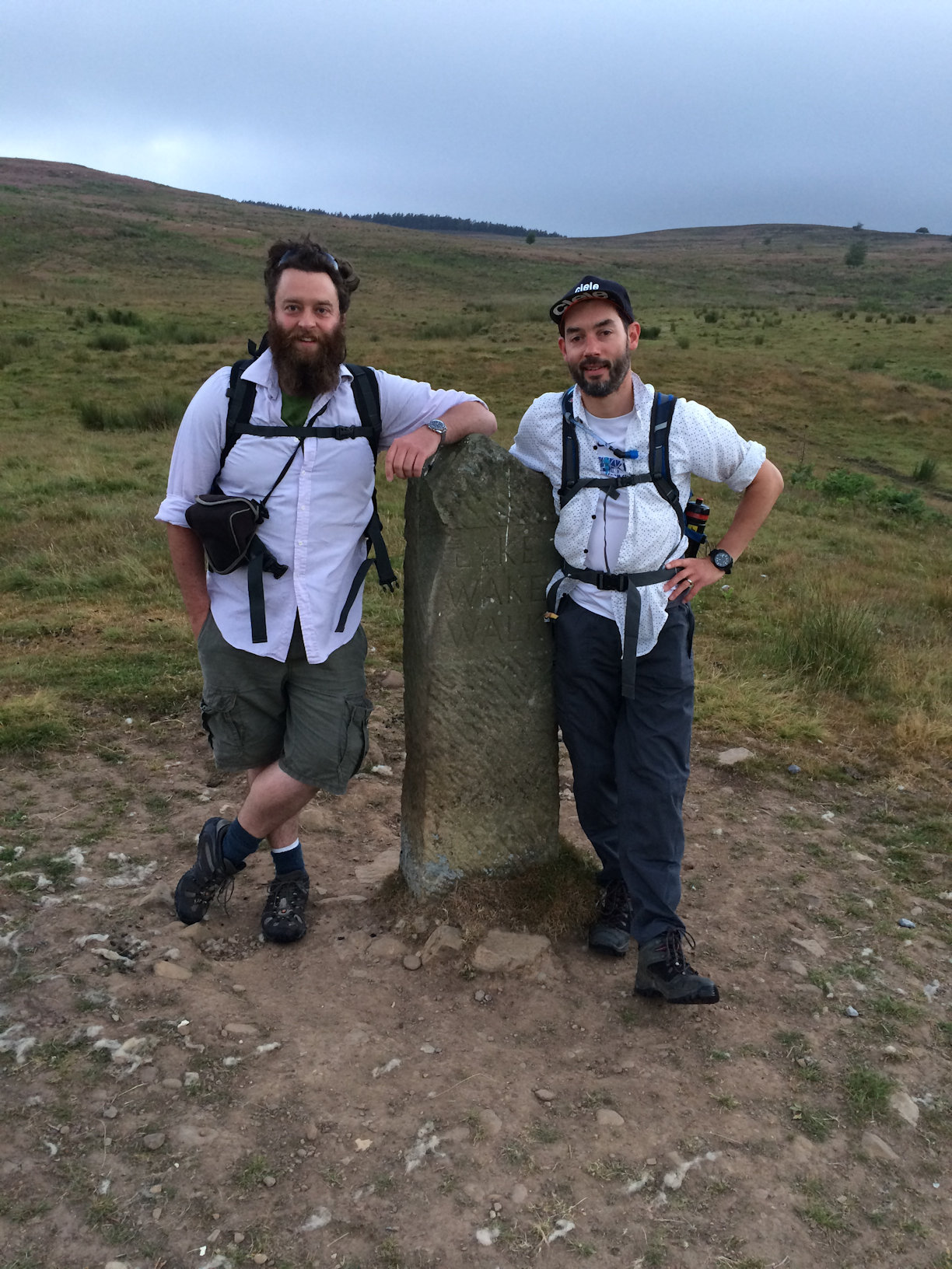
Team Newbiggin-by-the-sea were:
Jonathan Shipley (JS) – full walk
Mark Knight (MK) – full walk
Steven Abbott (SA) – to The Lion and then support
Crayke Challenge 7th – 8th July 2018
 We made our first check point at 10.40 at Chop Gate. Leaving there after 11.30 we had a very easy crossing to Blakey – head torches were needed as it was dark but we all wore Hi Viz vests too which helped. We arrived at Blakey pub at 3am (Unfortunately it was shut!) so we made our way to our next checkpoint round the top of Rosedale Head before the boggy section (which was actually really dry) He we had some support walkers join us to rally morale! We had a short stop after the bogs – planned incase we needed to change boots if wet! Our next section to Eller Beck was when it was really starting to get hot in the sun we arrived here about 10.30 and left after a serious hydration stop about 11ish. By 12.15 in the very hot conditions we could see the pylon from Lilla Howe . Because it was so hot we put in an additional check point on the Whitby Scarborough road we made it to the end at 3.20pm on Sunday 8th July. We have raise over £1000 and still getting money in for Yorkshire Air Ambulance.
Dianne
Crossing 14th July 2018
Greetings from Swanwick in Derbyshire!
I watched a serial on TV back in 2016 (I think) called “The Living and the Dead”. What struck me more than anything was the eerie and haunting theme tune. Investigation revealed this song to be the Lyke Wake Dirge.
Intrigued by the song and its history I soon discovered the Lyke Wake Walk. (Yes, I’d never heard of it before.)
A friend and I are members of a walking group in Derby. I suggested that it may be an interesting and exciting walk to do and it all started from there. The leader of our group, Richard Birkin, told us that he’d completed the walk some years ago (He had a tie somewhere to prove it) and volunteered his services as support. Another good friend, Mark Spencer (Why walk when I’ve got a car ?), offered his help too. We were up-and-walking.
Eventually, six of our group signed up:
Les Herbert
Geoff Johnston
Louise Disney-Smith
Lorraine Meakin
Roy Slack
Peter Allen
We were joined by:
Max Herbert
Rob Johnston
Rob “Cheese” Steel
Jordan Stapleton
Daniel Webb
Richard Green
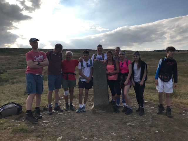
We set-off as one group from Osmotherley at about 2.30 a.m. Saturday 14th July and finished in two groups (Our age range being about 18 to 67 is probably why that happened) at the stone in Ravenscar at just gone 7 p.m. and about 8.30 p.m.
I think it’s safe to say that we all found the walk absolutely brutal, especially given the extremely hot conditions. The dry-boggy section, desert-like moorland and ravines were particularly strength-sapping and psychologically difficult. A lot of this walk is mind-over-matter, isn’t it? Those runners passing us all seemed so cheerful, too.
However, we were all massively proud to have completed it and become members of what has to be one of the most prestigious clubs in the world!
What glorious, loud jubilation
Is subject of feverish talk ?
A birth ? Or a King’s coronation ?
No, the end of the Lyke Wake Walk !
Thanks for being custodians of this great tradition.
Best regards,
Les Herbert
My first ultra – laying a demon to rest by Chris Roberts
Being quite old my relationship to the Great Outdoors goes back a long way. In October 1983, having stumbled across reference to the Lyke Wake Walk and having read Bill Cowley’s book on the subject, I made an unsuccessful unsupported solo attempt on the challenge walk. I then tended to keep to the nearer to home areas of Lakes, Dales and Pennines until this year when I completed the route as a competitor in the Lyke Wake Challenge, an annual race organised by the Quakers’ Running Club.

The LWW began as a challenge walk in 1955 with the aforementioned Bill Cowley being the principle instigator. The classic route starts near Osmotherley and finishes 40 miles later on the East coast at Ravenscar, having traversed the North York Moors. Start and finish points have been adjusted over the years and parts of the route have changed but it remains a similar challenge to cross the moors and bogs in less than 24 hours. Crossings can be completed in either direction and records also exist for double and triple (and more!) crossings. Joss Naylor took the record to 4.53 in 1979 and Mark Rigby’s 1984 time of 4.41 is the current record.
A few months ago I was casting around looking for a race around 40 miles to test the effects of the training I had been doing and The Lyke Wake Challenge seemed the obvious one to go for. Never having raced further than marathon distance it is a fair step up and at the same time would allow me to redress the balance by actually finishing the challenge!
I left entering until almost the closing day but then fell and injured my knee the next day. This set back my training and meant I arrived at the start line at 5.50 on 14th July less well prepared than I had hoped. Incidentally start times are handicapped based on previous performance or your own estimate of expected lapsed time. I suggested nine and a half hours based on nothing more than my roughly six hours on the Ingleborough marathon.
With me on the start line were four other runners. Three local lads who stuck together throughout and another chap who turned out to be a veteran of many crossings. The first part of the route takes you along the road from Cod Beck Reservoir but soon joins the Cleveland Way route through some woods and then onto the first decent climb. Conditions were already warm with little breeze but the views from the escarpment were good as early mists evaporated. I was feeling good and the knee was behaving so I more or less kept pace with the others who had started with me. I was a bit slow on the steep descent of Carlton Bank into the first checkpoint but spent little time there and pressed on for Clay Bank. This section is mainly good paths and tracks and we were making good time. I noticed at 6.4km (one tenth of the way) I had taken 48 minutes. If I could keep this up that would be an 8 hour crossing! As I was approaching checkpoint 2 I was delighted to see that Sophie had come up the hill to meet me and chase me in. At the checkpoint Sarah was also waiting for me with everything I might need. I am so grateful for my support team who had a long day and some interesting roads to drive along to keep me fully supplied. To be fair the checkpoints were all well stocked with food and drink and very cheery marshals as well.
Leaving Clay Bank there is another climb as we headed towards the highest point on the course. I had covered about 15km with another 14 to the next checkpoint. The path was still good as it shares the route with the Cleveland Way until Bloworth Crossing, where the Way turns north and the Lyke Wake makes use of an old railway line. Along this section I began to slow down although it is fairly flat and smooth. I was beginning to have aching quads which is unusual for me so early in a run, but was a result I think of straining them in a DIY related incident earlier that week. The view down into Farndale was some compensation but the heat was beginning to become oppressive. This was the section that did for me back in 1983 so I was glad to keep moving and arrive at the Lion Inn where Sarah and Sophie were once again in support. What a treat to get rice pudding and tinned peaches from the checkpoint team! I had a bit longer here while I stocked up on food and rubbed some Ibuprofen gel into my legs. I took a couple of paracetamol for good measure too.
Leaving the Lion Inn there is a couple of miles of road before striking off into the wilderness which is the infamous bog section. Normally you can expect to sink into deep bogs along here but with the extremely dry conditions following weeks of drought it was mainly dry all the way. Indeed some parts were as hard as concrete, with other bits nice springy peat. I had left the three lads back on the railway line but they passed me along here and stayed ahead all the way. Still, I racked up the first 32 km in around 4.38 so felt on schedule. The reality was that I was slowing down and later splits confirmed this.

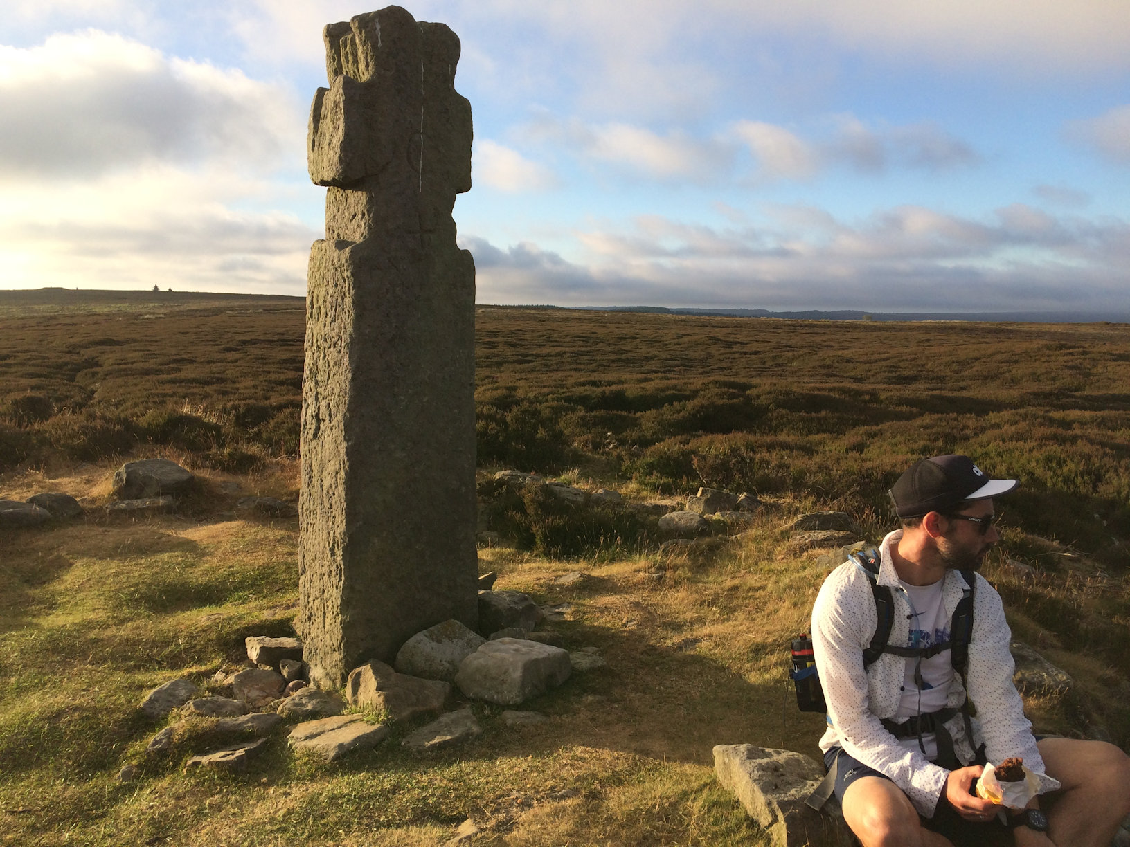
Running down into Hamer checkpoint I had covered 38.5 km in 5.37. It felt like late afternoon but was not yet even midday! I had another longish stop here to check my feet. This involved re-applying tape where I would expect a chance of blisters, but none were apparent yet. I had agreed that Sarah and Sophie would skip the next checkpoint as the road distances make it difficult to get there and to the next ahead of the runners. This wasn’t so bad as the legs are only 6 & 5 km. However I was now slowing even more, as the path became very rocky after Blue Man i’ th’ Moss (a standing stone). I wasted no time at checkpoint 5 but pressed on, down to Wheeldale Beck and back up and over Simon Howe to the NYMR railway line and so to Eller Beck, cp6. With the next and last checkpoint close to the finish this was to be my last prolonged pit stop so I refuelled and set off again at an even slower pace!
The next bit I found it harder to follow the path but I got back on it and took my phone out for the first time for a selfie at the cross on Lilla Howe. I was now crossing Fylingdales Moor and was out of the “bog” section, but was finding the stony track hard going. My right foot was sore if I hit any rocks so I walked much of this part. There was a drop down into the valley of Jugger Howe Beck then a climb out to the final checkpoint. Pausing only to guzzle a goodly quantity of electrolyte I pushed on, keen to beat 11 hours. It was already 4 o’clock but the last leg is only 3 miles. A nice grassy path leads up to the radio mast which I had first spotted long ago. Once there I opted to take the road route for the last mile or so to the finish at the Raven Hall Hotel. I was able to run all this part and even managed a sprint across the line, where I collected my most hard earned t-shirt ever! Total time 10.52, distance 65.26 km, height gain only 1215 m. (Footnote. Wake is the watching over a corpse and Lyke is the corpse itself).
Lyke Wake Crossing – Sunday 24 June 2018
Potential witches – Wendy Wadsworth and Michelle Dorgan
Driver/Cook/England football score updater – Lisa Carter
Statistics: 17 hours total time
15 hours walking time (as per Strava)
18 pee stops
Weather – sunny, dry with no wind (except as a result of eating too many flapjacks)
The alarm woke us from our pitiful sleep at 3am on Sunday morning, we packed our bags and had a quick breakfast and we left our ‘driver’ asleep in bed and headed off into the early morning light with a beautiful dawn chorus ringing in our ears.
We left our YHA at 4am and had a 2 mile walk to the start of the Lyke Wake Walk so we reached the stone marking the start of the walk at Scarth Wood Moor at 4.30am
.
The Explorer maps combined with the fact that I had read the Lyke Wake Walk Guide by Brian Smailes and gone over the route many times over the last few months made the journey more straight forward with only a few wrong turns.
The route to the first check point at Carlton Bank was very pleasant with a lovely walk through Clain Wood (remember the path off to the left beside the two seats or you will continue into the wood) and along the road at Hollin Hill to the long climb up through the wood to Round Hill, Gold Hill and along Carlton Moor. (The telephone box at Huthwaite Green had disappeared but there is a little post box) The dawn mist lifted and the view from Carlton Moor was magnificent. It was starting to warm up so our layers started to come off one by one.

The route to check point 2 displayed more views of Middlesborough and Guisborough and far across to Roseberry Topping in the distance. It was a hard slog up to Kirby Bank but an enjoyable walk on the path alongside Broughton Plantation. A lot of trees had been logged and the stone steps beside the wall were very difficult to see and we missed them so we went along the wide track to the road and saw check point 2.

The route to check point 3 (and our only official stop on the walk at the Lion Inn) was quite arduous. There were a few people on this route to talk to – walkers, mountain bikers and some lads on motorbikes racing past sending up a dust storm so strong we had to cover our mouths and nose to stop us coughing– and it was a lovely walk to Round Hill. The area around Blosworth Crossing was stunning.
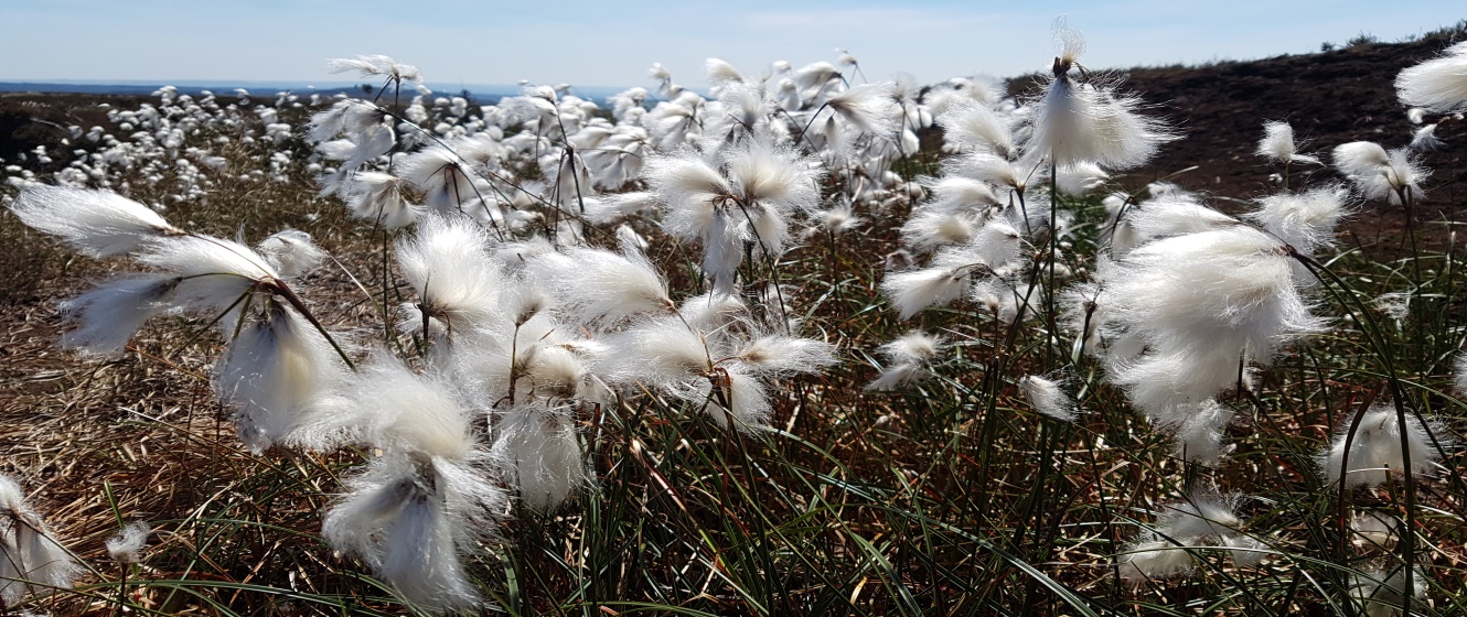
The long disused railway track seemed to go on forever however and we were desperate to see the red roof of the pub. We did see large patches of beautiful cotton grass which were pleasing to the eyes and so soft to touch.
We eventually saw the pub and took the little path to the left hand side of the pub and met our awaiting support team (Lisa). A toilet stop and a coke for me and a cider and cheesy chips for Michelle! I only allowed half an hour to refuel and stock up on water and snacks, enjoy a respite from the burning sun and replace blister plasters and socks!
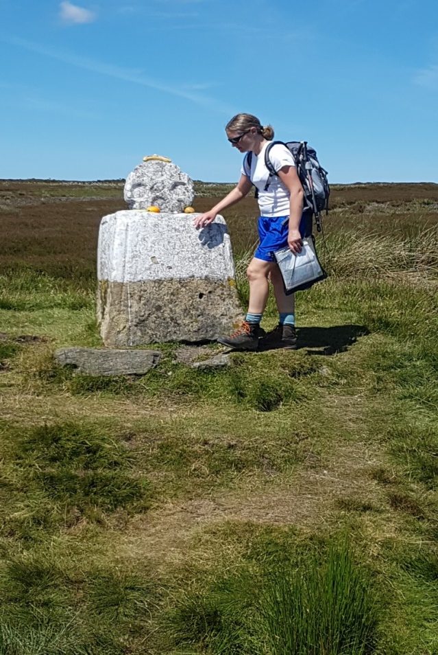
After saying goodbye to Lisa we continued along the really busy road up to Rosedale Head and stopped to take photos with ‘Fat Betty’. Other people had left fruit and snacks on ‘Betty’.
We continued along the road to the small car park in a little layby and took the path on the left to cross the ‘boggy’ section of the walk. As it had been so dry over the past few months, this area was quite dry and only a small number of bogs which could easily be crossed by either jumping across stumps of grass or just walking across. We crossed straight over the road to Hamer Bridge (checkpoint 4)

The track continued to Blue Man I ‘th’ Moss and we took the path straight on keeping the Wheeldale Plantation on our left. This path was very difficult as it was narrow and very rocky underfoot which slowed us down a great deal and sapped our energy.
We eventually crossed a small road and over a stile which reminded us to be wary of snakes and headed down the steep ravine to Wheeldale Beck which we crossed using the stepping stones and ascended up the other side, following a track to Simon Howe’s circle of stones.
We could see Lilla Howe in the distance and the military area of Fylingdales but were they getting any closer? Our tired legs carried us onwards.

We eventually came to the railway line where we crossed the little bridge which brought us out into a field of butterflies. There was a budding butterfly enthusiast who proceeded in showing Michelle the uncommon blue butterfly species.
We crossed the very busy A169 and reached Ella Beck Bridge. Continuing over the boggy area of Lilla Rigg we reached Lilla Howe. It took every ounce of our mental determination to keep walking. Our conversation was limited and so too was our water supply. Our feet were aching from the hard ground and the sun had almost completely sapped our energy but despite this we kept going.

Continuing over High Moor we reached the infamous Jugger Howe ravine which I had read so much about. It was much worse than it looked on the map and I had to drag my body down the ravine to Jugger Howe Beck to cross the little bridge and ascending the path opposite. From here you could see the cars on the main A171, Stony Marl Moor and the beacon signalling the end of the walk.
After crossing the main road and up the embankment the other side, we proceeded to walk along the track one foot in front of each other with our sights set on the beacon in the distance. Half an hour the book said, 30 minutes the book said! But it seemed a lot longer than that. We eventually reached the Lyke Wake Stone and finished the walk at 9.30pm with dusk gradually descending upon us. ‘Never again’ Michelle said. ‘Not for a while’ I said with a smile.
Report of crossings of Lyke Wake Walk
Gene Robinson 30th crossing.
Martin Robinson 2nd crossing.
Depart Ravenscar 8.11 pm Friday 6th July 2018.
Arrive Scarth Wood Moor 7.20pm Saturday 7th July 2018.
Total time 23 hours 9 minutes.
Total walking time 15 hours 13 minutes.
Three support stops.
Ellerbeck Bridge about 5 hours including 3-4 hours sleep.
Ralph Cross and Clay Bank Top between 1 and 1½ hours each.
Shorter rests along the way.
Weather and conditions excellent.
From August 1963 I (GR) walked Lyke Wake Walk regularly and by September 1980 had crossed 27 times. Thereafter (for various reasons.) crossings 28 and 29 didn’t come until 1990 and 1999 respectively and until this year I had not dirged in the 21st century/3rd millennium.
Lyke Wake lure lurked on though and when I recently decided to give it another (final?) go I thought I’d wait until reaching 75 years of youth, (which I did 11-2-18)
Son Martin had crossed with me in 1999. He’d come with me again.
Weather was perfect, hot after half way and there wasn’t a bog in sight. My driest crossing without doubt, (or should that be drought?)
There are seven OS triangulation pillars on or near the route. Martin and I visited them all. The one on Botton Head is easily included, although many bypass, Simon Howe requires a short but deliberate detour as does Loose Howe. This one is in a sorry state and is not only leaning, but sinking. We all know the feeling, but the flush bracket here is only just accessible.
The tester though is Louven Howe, which needs not just a detour but the determination not to allow Lilla Howe to be neglected in its stead. Lilla is a Lyke Wake highlight. Lilla must not be missed.
Would it be daft to suggest that the Lyke Wake Club take these (magnificent) seven under its wing? “Do” them up a bit, give ‘em a lick of paint. Don’t know what OS might say but modern technology has consigned these stones to history, there to join an illustrious band stretching from one end of the walk to the other.
Lyke Wake Triangulation Pillar Numbers
Scarth Wood Moor S4413
Carlton Bank S4421
Botton Head (Round Hill) 2988
Loose Howe 2955
Simon Howe S4370
Louven Howe S4392
Beacon Howes S1521
Gene Robinson 30 crossings (17 west-east)
Martin Robinson 2 crossings (1 west-east)
Crossing Report: Saturday 16th June 2018
After parking my car in the Sheepwash car park at the head of Cod Beck Reservoir, the first problem that faced me in this attempt at completing the Lyke Wake Walk was deciding on and locating the starting point. The route description provided at http://lykewake.org/route.php refers to a Stone at grid reference 470994. I could find no stone of any significance at that point, so resolved on starting from the stone inscribed “LYKE WAKE WALK” at grid reference SE467992 and also taking in what some consider the official start of the walk: the Ordnance Survey trig point at SE459997.
I started off at about 5:45 in fine weather thinking that I would have plenty of time to complete the walk in daylight. Here comes my first lesson learnt: just because I’ve previously completed a 40 mile challenge walk in southern England on well made up paths in 12 hours doesn’t mean the same can be achieved over the North York Moors, so don’t dawdle, keep moving!
The weather remained fine until I reached the Lion Inn, and it was about then that I heard distant thunder, and shortly afterwards there was a brief shower. Soon after passing Shunner Howe, I could see another storm approaching, and quickly found myself walking through heavy rain accompanied by thunder and lightning. My second lesson learnt was to check that waterproofs really are waterproof; my supposedly waterproof trousers certainly weren’t, but fortunately the storm soon passed and the weather remained dry for the remainder of the walk.
For a long time I could see RAF Fylingdales in the distance, and for a long time it didn’t seem to get any closer, but eventually I passed it, though it was about then that I realised I wouldn’t complete the walk in daylight. With just about sufficient light not to need my head torch, I was approaching the final trig point at NZ969011 when I was halted in my tracks by a sound I haven’t heard in many years: the churring of a nightjar, which was sitting on top of a bush close to the path; I stopped to listen for several minutes. At about 10:45 pm, 17 hours after starting, I reached the trig point, and then continued to the Raven Hall Hotel, the bar of which is apparently the traditional end point for the walk. I expect the bar was closed by the time I reached Ravenscar, but I didn’t investigate as all I wanted to do by this time was find somewhere to pitch my tent and get some sleep.
The following morning, fortunately feeling refreshed, I was faced with getting back to my starting point. Retracing my steps didn’t seem appealing, so instead I walked the 9 miles into Whitby along the old railway track, caught the train to Battersby – a pleasant hour long journey – and then walked the remaining 12 miles back to my starting point by the shortest and easiest route I could find.
David Tyers
******* Please note, David is quite correct. The start shown on our website map is incorrect. I will get that sorted as soon as possible. Thanks for pointing this out *********
Gerry.