The Lyke Wake Walk
THE LYKE WAKE WALK is a complete crossing of the North York Moors along their main east-west watershed between the Stone at grid reference 470994 and the Trig point at 971012, a distance of approximately 40 miles. The map below sketches out the line of the Walk:

The Walk may be done in either direction: this description is of a west to east crossing, starting just north of Osmotherley:

Image reproduced with kind permission of Ordnance Survey and Ordnance Survey of Northern Ireland.
The essential point is that there is no official route. As long as you start at the start and end at the finish (or indeed start at the finish and end at the start, the walk can be done either way) and keep as far as possible to the high ground, you can follow any suitable route. So in one sense you cannot get lost, you just take an alternative route. That said, there is a recognised way to go and we sketch it here; it is described in much more detail in the Lyke Wake Walk Guide Book. And there should always be somebody who knows where you are and when you are expected.
Please bear in mind that over time the path described below might have changed since this was last updated, please use this as a general information rather than a definitive guide.
From the start stone at the large car park follow the road north. After a kilometre, cross the cattle grid, and meet the Cleveland Way, whose well-signposted route you follow eastwards for about 18km/11 miles to Bloworth Crossing (follow the acorns). Here the Cleveland Way strikes north, and the Lyke Wake Walk follows the dismantled railway line for about 7km/ 4½ miles until it reaches the Lion at Blakey. As an alternative, you can follow the footpath from the railway line to Old Margery (avoiding the Lion Inn). Heading west to east after around 5½km/ 3½ miles along the railway and 300 metres / 350 yards after passing the junction that heads north to Eskdate, the path turns left at NZ 657005. The path is very vague but roughly follows a north-east line towards Flat Howe, emerging at Old Margery (stone). This path was closed for 20+ years but has been reopened and is passable once more.
From Blakey follow the road round until just after the Fryup turning. From there to Wheeldale the route is undefined, and broadly follows the boundary stones (and the District council boundary) to the Blue Man-i-th’-Moss standing stone, then along the watershed to the Wheeldale Road. Careful navigation is required, and the Lyke Wake Walk Guide Book (see our page with things to buy) will help you here. This stretch is about 17km/ 10½ miles long. The 6km/ 3½ miles from the Wheeldale Road to the A169 road at Eller Beck is popular with weekend walkers and consequently is much better defined. In short order you cross the Roman Road, the stepping stones over Wheeldale Beck, head up to the spectacular cairn at Simon How, then descend to Eller Beck Bridge.

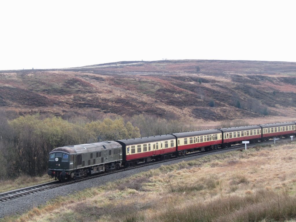
As you approach the road the early warning station on Fylingdales Moor is a prominent landmark which strangely never seems to get any closer (the famous “Golf Balls” are now a thing of the past.). As you approach the road, you cross the North York Moors Railway — keep a lookout here and if you are lucky you may see a train:

The route past the early warning station crosses MoD land. You can get through, but take care to follow the path along the bank of the stream. In more detail here is a suggested route:
Leave the car park and turn left along main road (It is possible to avoid the road by following the grass for 100 yards by turning left just before the road and descending parallel to the road to cross road opposite the army landrover track.) Cross road and turn right on army landrover track some 10 yards before bridge. Ascend gently on wide track for 5 yards to pass through wooden gate (SE 859 983) and continue on track with wire fence on your right. The track bears gently right to a point SE 862 985 where main track (grassed over) turns left and descends to stream.
At SE 866 934 the ground can become quite wet. In dry weather, continue ahead to cross stream by stream junction ( SE 866 984 ) using two footbridges that have been installed recently. Keep ahead aiming for the first white stake. Very shortly, the path becomes very narrow and is surrounded by heather. You will observe a line of white stakes parallel to the right – do be not be drawn to these but continue on path. This path has become more established in recent years. Follow the gradual ascent which is usually very wet underfoot. The path eventually merges with the army road/ track on the right.
At SE 88625 98667 pass through wooden gate and after 10 yards ahead crossing cross landrover track on a flagged path up to Lilla Cross. Looking north-east, one can see the open sea and east the radio mast at Ravenscar can be seen. Avoid the temptation to drift off to the south after leaving Lilla Cross.
It is about 3½km/ 2 miles to Lilla Cross and 6km/ 4 miles to the A171 road near Jugger Howe. North York Moors National Park have now completed a major restoration project affecting the Lyke Wake Walk at Jugger Howe with a pitched stone path providing a (steep) descent, a footbridge across the Beck and a similarly steep stone path back up to the metalled road.
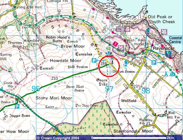
To say that from the A171 road it is “only” 2½km/ 1½ miles to the end at the trig point by the radio mast underplays the reserves of energy that need to be drawn on to climb that last hill, but it can be done and thousands have done it.
The original tradition was to continue the extra mile to the bar of the Raven Hall Hotel which in practice brings the total distance up to approximately 40 miles.

Image reproduced with kind permission of Ordnance Survey and Ordnance Survey of Northern Ireland
The images on this page are copyright © 2004 Challenge Publications and are used by permission, as is the extract from the Lyke Wake Walk Souvenir Sketch Map. More details on how to buy these on our things to buy page.